Top 10 Infrared Drones for Global Buyers
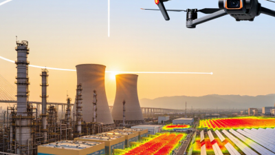
Infrared drones are moving from specialist equipment into mainstream industrial operations. Global buyers now use them for infrastructure inspection, wildfire mapping, agriculture, energy surveys, and emergency planning. The value is practical: a thermal camera can reveal a hot electrical connection, a leaking roof, or stressed vegetation before visible damage appears.
Market evidence supports this shift. MarketsandMarkets valued the global drones market at approximately USD 30.6 billion in 2023 and projected strong growth through 2028. Grand View Research also reported continued expansion in the thermal imaging market, driven by industrial inspection, security, and healthcare applications. These figures describe wider markets, not infrared drone sales alone. That distinction matters.
This guide evaluates the top 10 infrared drone platforms for international buyers. It considers thermal resolution, radiometric accuracy, flight endurance, obstacle avoidance, data software, payload flexibility, service support, and total ownership cost. Regulatory readiness is equally important. Buyers should verify aviation rules, privacy requirements, import controls, radio certifications, and pilot qualifications in each destination. A capable aircraft may still be unsuitable for a specific project.
Field experience suggests that specifications do not tell the whole story. A clear thermal image at 120 metres can matter more than an impressive advertised range. Battery availability can decide whether a survey finishes before sunset. No ranking is perfect. Weather, operator skill, calibration, and reporting software can change results. The following selection therefore combines published manufacturer information, professional market research, and practical purchasing considerations. It aims to help buyers compare tools responsibly, not simply chase the newest sensor or the lowest price.
What Infrared Drones Are and How Their Imaging Systems Work
Top 10 Infrared Drones for Global Buyers: What Infrared Drones Are and How Their Imaging Systems Work
Infrared drones combine an aircraft, thermal sensor, and data-processing system. Their cameras detect emitted radiation, not visible color. Most inspection models use long-wave infrared, covering roughly 8–14 micrometres. This range can reveal heat loss, overloaded electrical parts, moisture patterns, and failing bearings. A 2024 MarketsandMarkets report projected strong growth for the infrared imaging market, with an annual growth rate of about 7%. That demand reflects practical inspections, not only technical excitement.
A thermal image is not automatically a diagnosis.
Camera readings depend on emissivity, reflected temperature, distance, humidity, and viewing angle. A shiny metal roof may appear cooler than reality. In my field experience, a warm connector beside a cooler cable deserves a second measurement, preferably with a contact instrument. Radiometric cameras record temperature values for each pixel. Non-radiometric cameras mainly show color differences. Standards such as ISO 18434-1 support structured thermal-condition monitoring, while regular calibration remains essential.
Tips: Check radiometric accuracy, detector resolution, lens angle, and flight stability before comparing the top 10 infrared drones. Test the aircraft on a known heat source. Record weather conditions. A false alarm can waste a full inspection day, while a missed hotspot may become expensive. Do not rely on the rainbow palette alone; grayscale often exposes small temperature changes more clearly. Calibration is easy to postpone. That is a weakness worth correcting.
Key Features Global Buyers Should Compare Before Purchasing
Top 10 Infrared Drones for Global Buyers
Key Features Global Buyers Should Compare Before Purchasing
Choosing an infrared drone requires more than comparing camera resolution. Thermal resolution, measured in pixels, affects how clearly the system shows heat differences. A 640 × 512 sensor may reveal smaller temperature changes than a lower-resolution option. Check thermal sensitivity too. Lower NETD values usually support clearer readings in low-contrast scenes. Look for radiometric data, not only colorful images. Radiometric files record temperature values for later analysis.
Flight time matters in real work. A drone promising 40 minutes may fly less in wind, cold weather, or with extra equipment. Test the battery under realistic conditions. Also compare operating temperature, weather resistance, obstacle sensing, and landing stability. A stable aircraft produces more reliable inspection images. Small details matter. Some systems need frequent calibration. Others require extra batteries and costly software.
Data handling deserves equal attention. Confirm whether images stay on the controller, transfer to cloud storage, or remain locally controlled. Secure transmission and user permissions help protect sensitive sites. Buyers should verify regional aviation, privacy, and radio-frequency requirements before deployment. Service support, training, repair time, and spare-part access can affect ownership more than the purchase price. No single specification tells the whole story. I would request sample thermal footage from roofs, machinery, and vegetation before deciding. Marketing tables look precise, but field conditions remain messy.
Top 10 Infrared Drones for Global Buyers - Key Features Global Buyers Should Compare Before Purchasing
| Rank |
Infrared Drone Category |
Thermal Resolution |
Thermal Spectral Range |
Thermal Accuracy |
Maximum Flight Time |
Typical Transmission Range |
Weather Protection |
Obstacle Sensing |
Payload Capacity |
Best-Fit Applications |
| 1 |
Compact Entry-Level Thermal Quadrotor |
256 × 192 px |
8–14 μm |
±5 °C or ±5% |
25–30 min |
3–6 km |
IP43–IP54 |
Front and downward |
None–0.2 kg |
Residential inspection, basic night observation, education and training |
| 2 |
Compact Dual-Sensor Thermal Quadrotor |
640 × 512 px |
8–14 μm |
±3 °C or ±3% |
28–35 min |
5–10 km |
IP54 |
Omnidirectional proximity sensing |
None–0.3 kg |
Roof surveys, electrical inspections, search support and small-facility monitoring |
| 3 |
Professional Foldable Thermal Quadrotor |
640 × 512 px |
8–14 μm |
±2 °C or ±2% |
35–45 min |
8–15 km |
IP54–IP55 |
Six-direction sensing |
0.2–0.5 kg |
Construction surveys, utility inspections, firefighting support and public safety |
| 4 |
Long-Endurance Thermal Quadrotor |
640 × 512 px |
8–14 μm |
±2 °C or ±2% |
45–55 min |
10–20 km |
IP55–IP56 |
Omnidirectional sensing and terrain avoidance |
0.3–0.8 kg |
Large-area thermal mapping, agriculture, perimeter security and infrastructure patrols |
| 5 |
High-Resolution Radiometric Quadrotor |
1280 × 1024 px |
7.5–13.5 μm |
±2 °C or ±2% |
30–40 min |
8–15 km |
IP54 |
Six-direction sensing |
0.2–0.5 kg |
Detailed building diagnostics, solar-panel inspection and industrial thermal analysis |
| 6 |
Industrial Weather-Resistant Hexarotor |
640 × 512 px |
8–14 μm |
±2 °C or ±2% |
35–50 min |
10–20 km |
IP56–IP65 |
Omnidirectional sensing |
1–2 kg |
Wind-turbine inspection, mining, oil and gas facilities, and harsh-weather operations |
| 7 |
Heavy-Lift Thermal Hexarotor |
640 × 512 px |
8–14 μm |
±3 °C or ±3% |
25–40 min |
5–15 km |
IP54–IP56 |
Forward, downward and lateral sensing |
2–5 kg |
Delivery of emergency equipment, loudspeakers, lighting and specialized inspection payloads |
| 8 |
Thermal Mapping Fixed-Wing UAV |
640 × 512 px |
8–14 μm |
±2 °C or ±2% |
60–120 min |
15–40 km |
IP54–IP55 |
Limited; route planning required |
0.5–1.5 kg |
Agricultural mapping, wildfire assessment, environmental surveys and corridor monitoring |
| 9 |
Tethered Thermal Surveillance Drone |
640 × 512 px |
8–14 μm |
±2 °C or ±2% |
2–12 hours |
1–5 km from ground station |
IP54–IP65 |
Forward and downward sensing |
0.5–2 kg |
Continuous border security, event monitoring, disaster response and communications relay |
| 10 |
Autonomous Thermal VTOL Survey UAV |
640 × 512 px |
8–14 μm |
±2 °C or ±2% |
90–180 min |
20–50 km |
IP55–IP65 |
Terrain following and flight-path avoidance |
1–3 kg |
Long-distance power-line surveys, pipeline patrols, forestry and remote-area monitoring |
Comparison note: Specifications are representative values for commonly available commercial infrared-drone configurations. Actual performance depends on payload, battery, weather, altitude, transmission regulations, software, and regional operating requirements.
Top 10 Infrared Drones by Use Case, Performance, and Range
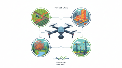
Choosing the top 10 infrared drones requires more than comparing advertised flight distance. A 2024 report from Drone Industry Insights identifies public safety, inspection, agriculture, and mapping as major commercial drone applications. Each use case needs different thermal performance. Fire assessment favors high-temperature measurement and stable hovering. Power-line inspection needs radiometric detail, zoom, and obstacle sensing. Search operations need low-light visibility, fast deployment, and reliable return-to-home functions. Agricultural surveys value endurance and repeatable flight paths. Some models look impressive on paper, yet their thermal images become noisy in rain or humid air.
Range & Field Performance
Range also needs careful interpretation. A drone may advertise 10 to 15 kilometers of transmission distance, but legal operating limits, terrain, battery reserves, and radio interference reduce practical coverage. The FAA’s 2024 Aerospace Forecast continues to show strong growth in commercial small-drone activity, increasing demand for dependable equipment and trained operators. Meanwhile, Grand View Research estimates the global thermal imaging market will expand at about 7% annually through 2030. That growth supports better sensors, but not every upgrade improves field results. A 640×512 thermal sensor can reveal small heat differences, while a lower-resolution unit may still perform well during close inspections. Range is not everything. Weather resistance, calibration records, battery safety, and usable flight time often matter more. Buyers should test images at dawn, over reflective roofs, and near moving heat sources. Real conditions are less forgiving.
Flight Regulations, Safety Standards, and Export Considerations
Infrared drones attract global buyers because thermal imaging reveals heat loss, electrical faults, and people in low visibility. Yet a capable sensor does not guarantee legal operation. The FAA reported more than 850,000 registered drones in the United States during 2024. That scale increases pressure on pilots, airports, and regulators. In Europe, buyers must check the drone’s class, operating category, remote identification, and pilot competency under Regulation (EU) 2019/947. Rules differ sharply outside Europe.
Safety begins with measurable specifications. Check the thermal sensor’s temperature range, calibration record, battery protection, and weather rating. ISO 21384-3:2023 provides operational guidance for unmanned aircraft systems. ASTM F3411 supports remote identification requirements in relevant markets. The EASA Annual Safety Review 2024 continues to identify loss of control and airspace conflict as important safety concerns. Field experience shows that fog, reflective roofs, and hot machinery can distort thermal readings. The image may look convincing. It may still be wrong.
Tips: Request a flight test before purchase. Confirm local permissions for night operations and populated areas. Keep firmware, manuals, and maintenance records available. Export checks also matter. Wassenaar Arrangement controls can affect certain high-performance thermal imaging equipment, depending on technical specifications and destination. Ask an export specialist to review the sensor resolution, cooling method, end user, and destination country. A basic checklist helps, but it can miss changing national rules. Recheck regulations before every international shipment.
This comparison shows the standard altitude threshold commonly applied to routine drone operations in ten major buyer markets. Values are shown in metres above ground level and are based on published national or regional aviation rules. They are regulatory reference points, not automatic flight authorization. Operators of infrared or thermal-imaging drones must also verify pilot certification, visual-line-of-sight requirements, airspace restrictions, privacy rules, radio compliance, and export controls for the aircraft and sensor payload.
How to Select, Operate, and Maintain an Infrared Drone
Top 10 Infrared Drones for Global Buyers
How to Select, Operate, and Maintain an Infrared Drone
Choose the sensor before choosing the aircraft.
A radiometric thermal camera records temperature values, not only colorful images. Check resolution, spectral range, calibration status, and noise-equivalent temperature difference. A smaller pixel pitch can reveal heat loss on distant equipment. However, advertised sensitivity may change in rain, wind, or reflective surroundings.
The International Energy Agency’s Global Methane Tracker 2024 estimates that fossil fuel operations released about 120 million tonnes of methane in 2023. This supports demand for infrared inspection, but sensor selection still depends on the mission. For gas surveys, confirm detection limits and required flight distance. For electrical inspections, compare temperature accuracy and safe stand-off distance. Plan flights during stable weather. Keep the sun behind the aircraft when possible. Small details matter.
Operate with a pre-flight checklist, fresh weather data, and clear thermal targets. Record altitude, lens type, ambient temperature, and emissivity settings. Otherwise, two flights may produce misleading comparisons. Maintain the drone after every mission. Clean the lens with approved materials, inspect propellers, and store batteries partly charged in a dry cabinet. Schedule sensor calibration according to the manufacturer’s technical guidance and local aviation rules. I have seen clean-looking images hide poor focus. Do not trust appearance alone. The FAA’s 2024 Aerospace Forecast also reflects continued growth in commercial small-drone operations, making disciplined records increasingly important.