



How to Choose the Best Search and Rescue Drone
Choosing a search and rescue drone is a practical decision, not a race to buy the model with the longest specification sheet. The right aircraft must fit the team, terrain, weather, and time available for a mission. A thermal camera may help locate a person after dark, while a high-resolution visual camera can reveal details in daylight. Neither sensor guarantees a reliable find. Operators still need sound search plans, clear communication, and training with the equipment they carry.
Look closely at flight time under realistic conditions, not only the manufacturer’s best-case figure. Wind, cold, payload weight, and repeated climbs can shorten a battery’s useful life. Check how quickly batteries can be changed and whether spare parts are accessible. Consider control range, image transmission, obstacle sensing, night capability, and how the drone performs when a signal weakens. Simple controls matter. Under pressure, complicated menus can slow a team down.
The best choice is the one responders can deploy safely and maintain consistently. Ask vendors for demonstrations using realistic search scenarios, and compare image quality, setup time, and support. Confirm that the aircraft fits your team’s procedures and applicable local aviation requirements. Test it before an emergency. A field trial may expose an awkward limitation that brochures never mention. That is useful, even if it changes the buying decision. No drone replaces trained people, careful coordination, or ground-based search methods. The technology can extend a team’s view, but its limits deserve equal attention.
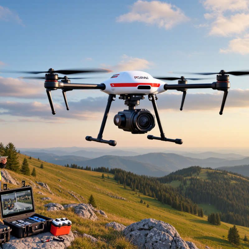
Define the Search and Rescue Mission Requirements
A rescue drone should match the search, not just look capable on a specification sheet. Define the missing-person scenario, search area, and expected flight time before comparing aircraft. A wooded ravine needs different coverage than an open shoreline. Note likely obstacles, wind exposure, and safe launch locations. Be specific. “Rough terrain” is not enough; mark slopes, tree cover, and possible landing spots on a map.
Tips: Write a one-page mission brief. Include the area size, daylight conditions, weather limits, crew experience, and how quickly the drone must be ready. Add the distance between the launch point and search zone. Small details matter.
Then decide what information crews need in flight. A thermal camera may help locate a warm person after dusk, while a visible-light camera can show clothing or ground features. Neither guarantees detection; branches, wet surfaces, and distance can reduce useful detail. Check whether live video reaches the field team reliably, and whether recorded imagery can be reviewed afterward. Set practical limits for battery reserve, signal range, and operating conditions. They may feel cautious, even inconvenient. That is better than planning around ideal weather that never arrives. Include who will interpret imagery and relay confirmed findings to responders. A capable aircraft is only one part of the search system.
How to Choose the Best Search and Rescue Drone - Define the Search and Rescue Mission Requirements
Use these illustrative planning prompts to define the mission before comparing aircraft. Example values are starting points, not universal requirements; verify them against local conditions, procedures, and aviation regulations.
| Requirement Dimension | Questions to Define | Illustrative Planning Requirement | Why It Matters for Drone Selection |
|---|---|---|---|
| Mission type | Will the aircraft search for a missing person, assess a hazard, locate a vessel, or support a ground team? | Specify the primary task and any secondary tasks, such as mapping access routes or relaying live imagery. | The task determines the necessary sensors, flight pattern, image detail, and communications setup. |
| Search area and terrain | How large is the search area, and does it include forest, open ground, mountains, water, or built-up areas? | Map the area and identify terrain, vegetation, elevation changes, launch sites, and likely obstacles. | Terrain and vegetation affect visibility, route planning, signal coverage, and the aircraft’s ability to maintain a useful search altitude. |
| Response time | How quickly must the aircraft be ready to launch after a callout? | Set a target deployment time and account for transport, assembly, battery checks, and airspace coordination. | A rapidly deployable system may be more useful than a higher-performance aircraft that takes longer to prepare. |
| Flight endurance | How long must each sortie last, including travel to the search area and return? | Set a minimum usable flight time for the expected route, with a return and landing reserve appropriate to the operation. | Advertised endurance may not reflect time available for searching; payload, wind, temperature, and flight profile can reduce it. |
| Operational range | How far from the launch point must the aircraft operate, and where will the pilot and observers be positioned? | Define the required route distance and maintain the required visual contact or approved operating authorization. | Control-link range is not the same as legally permitted operating range. Terrain, buildings, and interference can also affect connectivity. |
| Detection sensors | Will searches take place in daylight, darkness, low visibility, or mixed conditions? | Choose visible-light imaging for daylight observation; consider thermal imaging when heat contrast may help locate a person, and assess both sensor types where appropriate. | Thermal imagery can help identify heat signatures but does not guarantee detection, especially through dense vegetation or when environmental conditions reduce contrast. |
| Image detail and coverage | What must operators recognize, and how much ground must be covered per flight? | Define the target size, expected search altitude, camera field of view, and the image detail needed for the task. | Higher detail may require lower flight or slower movement, which can reduce area covered during a sortie. |
| Weather and environment | What wind, precipitation, temperature, dust, or salt-spray conditions are likely? | Set operating limits using the aircraft’s documented limits and the organization’s safety procedures. | Weather can affect flight stability, usable endurance, sensor performance, and safe takeoff and landing. |
| Communications and coordination | How will live information reach the incident command team, and who will coordinate airspace? | Define the required video or data link, recording method, communications roles, and coordination process before deployment. | Useful imagery must reach the right people reliably; operations also need to avoid conflicts with crewed aircraft and other responders. |
| Launch and recovery | Are suitable launch and landing sites available, or must the aircraft operate from a confined or uneven location? | Identify safe launch areas, recovery options, obstacles, and a contingency landing plan. | Site constraints may determine the aircraft configuration and whether additional ground equipment or personnel are needed. |
| People and training | How many trained operators are available, and what roles are required during a sortie? | Assign pilot, observer, sensor, and incident-command responsibilities as required by the operation and applicable rules. | Staffing and training affect safe workload, observation quality, and the ability to interpret and act on information. |
| Data handling | What imagery must be saved, shared, or protected after the mission? | Define recording, time and location tagging, access, retention, and secure sharing procedures. | Consistent data handling helps teams review findings, coordinate follow-up, and meet privacy and recordkeeping obligations. |
| Regulatory and safety constraints | What aviation rules, airspace restrictions, privacy requirements, and local procedures apply? | Confirm applicable approvals, operating limits, observer requirements, and emergency procedures before flight. | Legal and safety constraints determine where, when, and how the mission can be conducted, regardless of aircraft capability. |
Related Posts
-
7 Tips for Choosing a Search and Rescue Drone
-
Find the Best Search and Rescue Drone for Your Needs?
-
How to Choose the Best Search and Rescue Drone for Your Needs?
-
Top Search and Rescue Drone Solutions for Global Buyers?
-
How to Use a Surveillance Drone for Effective Monitoring?
-
2026 How to Use a Construction Drone for Efficient Building Projects?