China has become a significant source of professional aerial mapping equipment, including LiDAR platforms for surveying, forestry, construction, and infrastructure inspection. This guide introduces ten China-based LiDAR drone manufacturers serving international buyers. It focuses on practical capability rather than impressive slogans.
A lidar drone should deliver more than dense point clouds. Buyers need stable flight control, accurate positioning, reliable sensor integration, and usable data after landing. Battery endurance matters on steep forest slopes. Payload capacity matters when combining LiDAR, RGB, and thermal cameras. Software compatibility also affects daily productivity. A survey team may value direct GeoTIFF, LAS, or point-cloud workflows more than a polished demonstration.
Real field conditions reveal weaknesses. Dust, wind, uneven terrain, and limited network coverage can change results quickly. This comparison considers product design, manufacturing experience, system support, documentation, and export readiness. It also examines calibration practices, training, warranty response, and compatibility with common mapping software. Certifications and test reports should be checked independently before purchase.
No ranking remains perfect.
Manufacturer information can change. Some companies show strong hardware but provide limited overseas support. Others offer dependable service but less flexible customization. That difference deserves attention. Global buyers should request sample datasets, flight logs, accuracy reports, and clear after-sales terms. Local aviation rules, privacy requirements, and operational permissions must also be reviewed before deployment. The following overview aims to support careful decisions through verifiable details, practical experience, and balanced judgment. It may not answer every project-specific question, but it can make the right questions easier to ask.
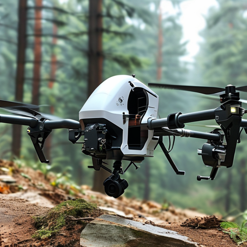
LiDAR drones combine a laser scanner, positioning system, camera, and flight platform. The scanner sends rapid pulses toward the ground. It measures return time and builds a three-dimensional point cloud. This reveals terrain beneath light vegetation, construction progress, road edges, and drainage features. Unlike ordinary photographs, LiDAR data can preserve elevation details in shadowed or uneven areas.
A reliable mapping mission needs more than a capable aircraft. Survey teams check sensor calibration, satellite visibility, battery condition, weather, and local airspace requirements. They may place ground control points before takeoff. The drone then follows planned flight lines with consistent overlap and altitude. After landing, specialists remove noise, classify points, and compare results with known checkpoints. These steps support digital elevation models, contour maps, corridor surveys, and volume calculations for international projects.
Field experience also exposes limitations. Dense wet vegetation can weaken returns. Strong wind can reduce flight stability. Processing errors may appear as false ground or missing edges. No workflow is flawless. Teams should record flight logs, sensor settings, coordinate systems, and quality checks for every project. Cross-border work adds another concern: data storage, privacy, and aviation rules differ between regions. A lower price may look attractive, but weak support or unclear accuracy reports can delay an entire mapping schedule. Independent sample data and documented testing deserve careful review.
China Top 10 LiDAR Drone Manufacturers for Global Buyers
When evaluating Chinese LiDAR drone manufacturers, published specifications should not be your only evidence. Drone Industry Insights reported that the global commercial drone market continued expanding in 2024, increasing pressure on suppliers to prove real-world performance. Ask for independent flight logs, calibration records, and sample point clouds. Check vertical accuracy, scan range, point density, RTK/PPK stability, and flight endurance under full payload. Numbers can look impressive.
A reliable manufacturer should provide ISO 9001 production controls, traceable sensor calibration, and clear after-sales procedures. The ASPRS Positional Accuracy Standards offer a useful reference for checking geospatial results. Compare root mean square error, not only advertised centimeter-level accuracy. Request data from forests, power corridors, construction sites, and uneven terrain. One polished test may hide weaknesses. I would also inspect battery cycle data, spare-part availability, software export formats, and training support. These details often determine project downtime.
Tips: Require a paid pilot survey before a large order. Confirm warranty coverage, firmware update policies, import documents, and local technical response times. MarketsandMarkets has projected strong growth in the LiDAR market through the decade, but growth does not guarantee consistent quality. Leave room for doubt. A manufacturer that admits limitations may be more dependable than one promising perfect results.
| No. | Evaluation Dimension | What Global Buyers Should Check | Practical Benchmark or Reference | Required Evidence | Business Importance |
|---|---|---|---|---|---|
| 1 | LiDAR Sensor Performance | Check laser wavelength, measurement range, point-measurement rate, field of view, scan pattern, return capability, and performance in vegetation or low-texture environments. | Published specifications should clearly state operating range, angular coverage, point rate, and accuracy conditions rather than listing only a nominal range. | Official datasheet, laboratory test report, sample point cloud, and a field demonstration using the buyer’s target terrain. | Determines point-cloud density, target detection, survey productivity, and suitability for mapping, forestry, mining, or infrastructure. |
| 2 | Positioning and Georeferencing | Evaluate GNSS, RTK or PPK support, inertial navigation, base-station compatibility, correction services, and performance when satellite signals are obstructed. | The system should document horizontal and vertical accuracy separately and identify whether results depend on RTK corrections, PPK processing, or ground control points. | Accuracy test report, supported correction formats, trajectory file, ground-control comparison, and repeatability results. | Reliable georeferencing reduces rework and supports engineering, cadastral, volumetric, and inspection deliverables. |
| 3 | Drone Platform Compatibility | Review payload capacity, mounting method, vibration isolation, power interface, aircraft endurance, take-off weight, and compatibility with multirotor or fixed-wing platforms. | The complete payload configuration should remain within the aircraft’s certified payload and endurance limits, with no material reduction in flight stability. | Integration drawings, payload weight, power requirements, flight-time test data, and aircraft certification or conformity documents where applicable. | A well-integrated system improves flight safety, data consistency, and operational efficiency. |
| 4 | Data Quality and Processing Workflow | Assess time synchronization, inertial calibration, strip adjustment, noise filtering, trajectory processing, classification tools, and compatibility with common point-cloud formats. | The workflow should support standard outputs such as LAS or LAZ and provide documented processing steps from raw data to classified point cloud. | Raw sample files, processed sample files, software manual, export-format list, and processing-time demonstration. | Efficient processing lowers labor costs and simplifies integration with GIS, CAD, BIM, and surveying software. |
| 5 | Accuracy Validation and Quality Control | Check whether accuracy claims identify test conditions, flight altitude, surface type, scan angle, control method, and statistical measurement method. | Independent or witnessed tests should compare the point cloud with surveyed checkpoints and report results using a recognized accuracy methodology. | Third-party validation, checkpoint coordinates, test procedure, calibration certificate, and quality-assurance checklist. | Transparent validation is essential for contracts involving engineering tolerances, asset inventories, and regulatory submissions. |
| 6 | Flight Safety and Reliability | Evaluate obstacle sensing, return-to-home behavior, lost-link protection, geofencing options, weather resistance, battery monitoring, and redundancy of critical systems. | Safety functions should be documented, testable, and configurable for the operating country and mission environment. | Risk assessment, flight logs, environmental test results, maintenance records, and documented emergency procedures. | Safety and reliability directly affect personnel protection, equipment loss risk, insurance, and project continuity. |
| 7 | Regulatory and Export Readiness | Confirm documentation for radio equipment, battery transport, electromagnetic compatibility, product safety, remote identification, and local unmanned-aircraft operating rules. | Compliance must be assessed for the destination market; a certificate issued for one jurisdiction does not automatically satisfy another jurisdiction. | Declarations of conformity, test reports, user manuals, transport documents, serial-number records, and export-control screening information. | Proper documentation reduces customs delays, approval risk, and operational restrictions after delivery. |
| 8 | Software, API, and Interoperability | Check language support, user permissions, offline operation, cloud dependence, API availability, coordinate-system handling, and compatibility with existing survey workflows. | The buyer should be able to export usable raw and processed data without being locked into a single proprietary platform. | Software trial account, API documentation, supported formats, cybersecurity policy, and data-ownership terms. | Interoperability protects existing investments and makes multi-country deployment easier. |
| 9 | After-Sales Service and Spare Parts | Review warranty coverage, repair locations, response time, firmware support, calibration service, battery replacement, training, and availability of critical spare parts. | Service-level commitments should define response times, repair procedures, replacement conditions, and support responsibilities in the buyer’s region. | Warranty policy, service-level agreement, spare-parts list, support contacts, training plan, and references from international users. | Strong support minimizes downtime and protects the total cost of ownership. |
| 10 | Total Cost of Ownership and Supplier Capability | Compare equipment price with batteries, chargers, software licenses, calibration, training, shipping, import costs, repairs, upgrades, and expected service life. | A reliable comparison should use a multi-year ownership model rather than the initial purchase price alone and should include delivery lead time and production capacity. | Detailed quotation, bill of materials, production lead time, factory audit, quality-management records, and lifecycle-cost estimate. | A complete cost and capacity review improves budgeting, procurement planning, and long-term supply security. |
| Buyer note: Performance figures should be compared only when the test conditions, flight altitude, surface type, positioning method, processing workflow, and accuracy standard are equivalent. Request a representative field trial before making a final supplier decision. | |||||
China’s top 10 LiDAR drone manufacturers are gaining attention from global survey buyers. Their core strengths differ across airframes, sensors, software, and after-sales support. Grand View Research estimates the global drone LiDAR market will expand at over 20% CAGR through 2030. That growth reflects demand for faster mapping, safer inspection, and lower field labor costs.
Several leading Chinese manufacturers focus on lightweight drone platforms with centimeter-level positioning. Others develop long-endurance aircraft for forests, power corridors, and large construction sites. Their strongest systems combine LiDAR, RGB cameras, RTK, and terrain-following flight control. Some suppliers also offer SLAM processing for areas with weak satellite signals. That matters inside tunnels, under bridges, and near dense buildings. Practical testing remains essential.
According to MarketsandMarkets, the broader LiDAR market is projected to reach more than 4 billion US dollars by 2028. Chinese manufacturers respond with competitive payload integration and increasingly capable data platforms. Many provide point-cloud classification, digital elevation models, and automated inspection reports. However, advertised accuracy can depend heavily on flight speed, vegetation, weather, and operator training. This is often overlooked. Buyers should request sample datasets, calibration records, software trial access, and regional service terms. A low purchase price may hide slower processing or difficult firmware support. Rankings are useful, but not absolute; project conditions can change the best choice.
Choosing among the top ten LiDAR drone manufacturers requires more than comparing sensor range. Field teams should examine point density, accuracy, flight endurance, payload weight, and software workflow. Grand View Research estimates that the global LiDAR market could grow at about 14% annually from 2024 to 2030. That growth reflects demand for faster surveying, not merely better hardware.
A practical platform should produce clean point clouds in forests, quarries, roads, and construction sites. Sensor performance matters under changing sunlight and moderate wind. Software is equally important. Automatic strip alignment, ground classification, digital terrain models, and standard export formats can reduce office hours. Drone Industry Insights reported strong expansion in commercial drone services through 2030, with mapping among the major application areas. However, published accuracy claims need careful testing. Real terrain often exposes limitations.
Buyers should request sample datasets, calibration records, and repeatability results. A lightweight system may suit corridor mapping, while a heavier platform can carry larger batteries and additional cameras. Processing speed also affects project costs. In my experience, a slightly lower-resolution sensor can be more useful when its software is stable and field crews understand it. That is easy to underestimate. Reported range may also decline in dense vegetation, steep slopes, or poor satellite visibility. These details deserve direct verification before procurement.
Selecting a Chinese LiDAR drone supplier requires more than comparing product prices. Global buyers should examine flight stability, laser accuracy, GNSS and IMU quality, battery endurance, and payload capacity. Ask for independent test reports and sample point-cloud data. A supplier should explain accuracy under forests, construction sites, and uneven terrain. Clear answers matter.
Request a live demonstration or a controlled trial. Check whether the drone maintains stable flight in wind and supports safe return functions. Review calibration records, maintenance instructions, software compatibility, and data export formats. The best supplier can provide detailed technical documents, not vague claims. Short response times are useful, but engineering support is more important.
Look closely at production quality and after-sales service. Confirm spare-part availability, operator training, warranty terms, and remote troubleshooting procedures. Ask how the supplier protects collected data and supports local import, aviation, and privacy requirements. A low quotation may hide training costs or limited support. No supplier is perfect. I would record every weakness, even small delays during testing, before signing a contract. A transparent factory that accepts difficult questions is often safer than one offering polished presentations.